

Key Takeaways
What Connects These Five Parks
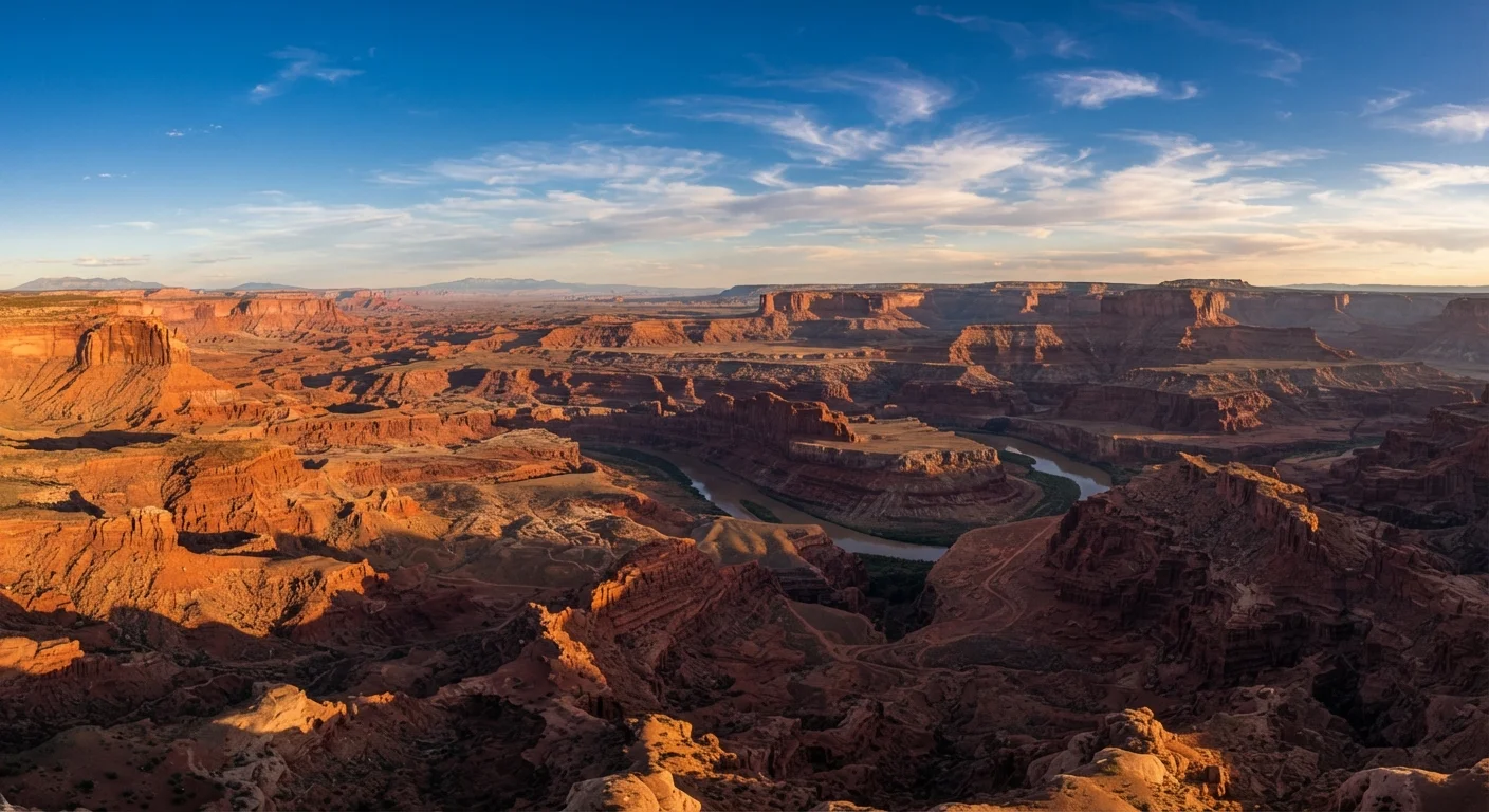
Zion, Bryce Canyon, Arches, Canyonlands, and the Grand Canyon share more than proximity on a map. All five sit atop or along the edges of the Colorado Plateau, a high desert uplift covering roughly 130,000 square miles across Utah, Arizona, Colorado, and New Mexico. Over hundreds of millions of years, rivers, wind, and dramatic shifts in sea level deposited and then eroded thousands of feet of sedimentary rock — limestone, sandstone, shale — leaving behind the formations visitors see today.
What makes each park distinct is which chapter of that geological story it exposes. The Grand Canyon reveals the deepest and oldest layers. Bryce sits at higher elevation and shows a younger, frost-sculpted landscape. Arches and Canyonlands display mid-story sandstone in very different arrangements. Zion cuts a slot canyon narrative entirely its own.
Understanding this shared origin helps visitors appreciate why the parks complement rather than duplicate each other. For a broader orientation to national park systems before you travel, see what first-time national park visitors need to know.
~500 mi
Approximate loop distance connecting all five parks
A road-trip loop from Las Vegas through Zion, Bryce, Arches, Canyonlands, and the Grand Canyon covers roughly 500 miles, making it one of the most drivable great-parks circuits in the US.
2,000+
Natural arches in Arches National Park
The National Park Service documents more than 2,000 natural sandstone arches within Arches National Park's boundaries.
277 mi
Length of the Grand Canyon along the Colorado River
The Grand Canyon stretches approximately 277 river miles, with depths exceeding one mile at its lowest points.
9,000 ft
Maximum elevation at Bryce Canyon
Bryce Canyon's rim reaches approximately 9,000 feet above sea level, making it the highest of the five parks and noticeably cooler than Zion or Arches.
Park by Park: Geology, Terrain, and Signature Experiences
Grand Canyon (Arizona)
At its deepest, the Grand Canyon exposes rock nearly two billion years old. The canyon stretches roughly 277 river miles and reaches depths exceeding a mile. The South Rim — accessible year-round — offers viewpoints reachable by car, while the North Rim closes in winter. The sheer scale here is the experience; no photograph adequately prepares a first-time visitor.
Zion (Utah)
Zion's Virgin River carved a narrow sandstone canyon that creates some of the most dramatic enclosed hiking in the country. The Narrows — wading up the river itself — and Angels Landing's chain-assisted ascent are signature experiences. The park sits at a lower elevation than its neighbors, making it warmer and accessible earlier in spring.
Bryce Canyon (Utah)
Technically not a canyon but an amphitheater, Bryce sits at elevations between 8,000 and 9,000 feet. Frost action — not water alone — sculpted its famous hoodoos (tall, thin rock spires). The rim trail at sunrise offers one of the Southwest's most photographed landscapes.
Arches (Utah)
More than 2,000 natural sandstone arches exist within the park's 76,000 acres. Delicate Arch, which appears on Utah's license plate, requires a moderate 3-mile round-trip hike. The park is geologically young compared to the Grand Canyon and visually more intimate in scale.
Canyonlands (Utah)
Divided into three districts — Island in the Sky, The Needles, and The Maze — Canyonlands is the least-visited and most remote of the five. Island in the Sky offers sweeping canyon overlooks accessible by paved road. The Maze requires four-wheel drive and serious backcountry preparation.
Trail Difficulty Across the Five Parks
Difficulty ratings across these parks are genuinely variable, and the desert environment amplifies perceived effort. Heat, altitude, and limited shade change everything.
Always check a trail's elevation gain alongside its distance — at Bryce, short trails descend steeply into the hoodoos, meaning the hardest work comes at the end when you're already tired and potentially altitude-affected.
Elevation change is a better predictor of effort in the Southwest than mileage alone, and many visitors underestimate return climbs in thin, dry air.
Carry at least one liter of water per hour of hiking regardless of weather, and start drinking before you feel thirsty — desert air wicks moisture without the usual sweat signals.
Dehydration and heat illness are among the most common medical emergencies across all five parks, and the dry, high-altitude air accelerates fluid loss faster than most visitors expect.
- Easy: Bryce rim trail, Arches's Windows section, Grand Canyon's South Rim viewpoint walks
- Moderate: Delicate Arch at Arches, Emerald Pools at Zion, Canyonlands Island in the Sky overlooks
- Strenuous: Zion Narrows, Angel's Landing, Grand Canyon's Bright Angel Trail to the river (a full day), Canyonlands Needles backpacking
Bryce is the most accessible park for visitors with limited mobility, offering paved rim overlooks and shorter loop trails. Canyonlands' Maze district is genuinely expert-level backcountry. The Grand Canyon's rim-to-river hikes should never be treated as casual — the National Park Service advises against attempting a same-day rim-to-river-and-back hike in summer.
Do Not Underestimate Desert Conditions
Trails rated 'moderate' in temperate parks may feel strenuous here due to heat, altitude, and exposed terrain. The National Park Service strongly advises against hiking Grand Canyon's inner canyon trails in summer midday heat. Always carry more water than you think you need, tell someone your hiking plan, and turn back before you feel forced to.
Logistics: Timing, Permits, and Entry
Spring (April–May) and fall (September–October) are peak seasons at most of these parks, offering cooler temperatures and fewer extreme weather events than summer or winter. Summer brings intense heat at lower-elevation parks like Zion and Arches, with temperatures regularly exceeding 100°F in July.
Timed-entry and permit requirements vary by park and trail:
- Zion: Angels Landing requires a permit through a lottery system. The park itself uses a shuttle system from the town of Springdale during peak season — personal vehicles cannot access the main canyon road.
- Arches: A timed-entry reservation has been required during peak periods; check the official NPS site before your visit since reservation windows change seasonally.
- Grand Canyon, Bryce, Canyonlands: No timed-entry reservations currently required for standard rim access, though backcountry camping requires permits.
All five parks charge entrance fees, and the America the Beautiful annual pass — available through the National Park Service — covers entrance to all of them. For camping logistics, how campsite reservations work across the national park system offers detailed guidance.
Entry requirements, permit systems, and reservation windows change. Always verify current conditions on the official NPS website before your trip.
Planning a Multi-Park Road Trip
A logical loop connecting all five parks runs roughly 500 miles. A common route starts in Las Vegas (the most accessible major airport for this region), heads to Zion, continues to Bryce, then northeast to Capitol Reef (worth a stop), into Moab for Arches and Canyonlands, and south through Monument Valley before returning via the Grand Canyon's South Rim and back west.
Gateway towns matter for rest and resupply: Springdale for Zion, Bryce Canyon City for Bryce, Moab for Arches and Canyonlands, and Tusayan or Williams for the Grand Canyon's South Rim.
Pair Parks That Share a Base Town
Moab makes a natural base for both Arches and Canyonlands — the park entrances are less than 10 miles from each other, allowing a two- or three-night stay to cover both without daily long drives. Similarly, Springdale sits at Zion's entrance and is an easy day trip from Bryce. Structuring your itinerary around these geographic clusters reduces driving fatigue significantly.
A realistic minimum for seeing all five parks with meaningful trail time is 10 to 14 days. Trying to rush all five into a week typically means long driving days and surface-level visits. If time is limited, Bryce and Zion pair well together (they're about 80 miles apart), as do Arches and Canyonlands (the entrances are less than 10 miles from each other in Moab).
If the full five-park circuit feels like too much, lesser-known US destinations can round out a Southwest itinerary with more breathing room.
What to Realistically Expect
These parks are among the most visited in the United States, and crowds are a genuine factor at peak times. Parking at Arches can fill before 8 a.m. on spring weekends. The Grand Canyon's South Rim viewpoints are congested from late morning through mid-afternoon in summer. This is manageable with early starts — sunrise visits consistently offer better light, fewer people, and cooler temperatures.
Crowds Are Manageable With Timing
Arriving at trailheads before 7:30 a.m. during peak season dramatically changes the experience at Arches and Zion. Most visitors arrive mid-morning; early starts consistently mean open parking, cooler air, and better photography light. Shoulder-season visits — late September through October and April — offer the best balance of weather and crowd levels.
Wildlife encounters are possible throughout the region: mule deer, ravens, condors at the Grand Canyon, and the occasional rattlesnake on rocky trails. Standard advice applies: maintain distance, never feed animals, and watch your footing on exposed ledges.
Cell service is limited or absent in large portions of all five parks. Download offline maps before you arrive. Paper maps available at visitor centers are genuinely useful here, not merely decorative.
For readers still sorting out how these parks differ in designation and what rules apply, understanding the difference between national parks and other federal land designations clarifies the distinctions that affect fees, permits, and access. And for a reality check on common assumptions, common myths about visiting US national parks is worth reading before you go.